
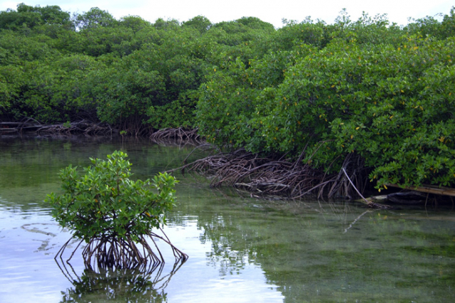
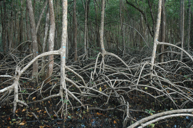
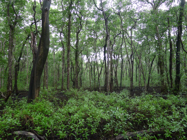
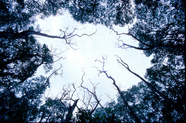
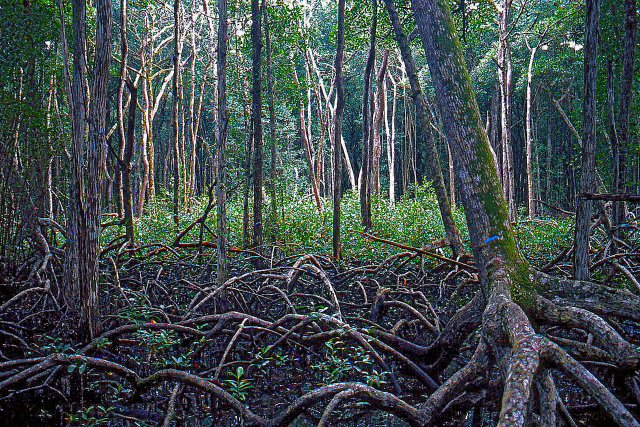
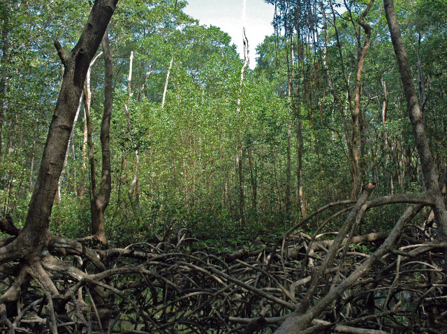
My current research examines the role of disturbance-generated light gaps in structuring mangrove forests on the Caribbean coast of Panama. The study forests are on Punta Galeta, adjacent to the Smithsonian Tropical Research Institution’s Galeta Marine Laboratory, ~ 8 km northeast of the city of Colón. These forests are comprised of three canopy tree species, Avicennia germinans, Laguncularia racemosa, and Rhizophora mangle. These species exhibit a pattern of zonation with distance from the shoreline that is typical of most Caribbean mangrove forests; Rhizophora grows in a pure stand at the seaward forest edge. About 10–20 m from the water’s edge, Laguncularia joins the canopy, forming a nearly even mixture with Rhizophora in the low intertidal. Avicennia enters the canopy in the mid-intertidal, creating a mixed canopy of the three species, and it then gradually monopolizes most upper intertidal stands. Laguncularia often reappears in the canopy near the upland edge, growing as scattered individuals or small monospecific stands along the mangrove–rain forest ecotone. This tidal distribution pattern is altered by disturbance in the form of lightning strikes that hit the forest canopy, killing as many as 60 trees in a single strike. Hurricanes very rarely strike the Caribbean coast of Panama, so damage by bolts of lightning generated in large thunderstorms is the primary agent of canopy tree mortality in our study area. Dead trees remain standing for several years before decay ultimately brings them down. The canopy clearings allow sunlight to reach the forest floor and soil nutrients become more available, making these gaps primary sites of canopy tree regeneration. Using long-term sampling of permanent plots and a variety of field experiments, I am investigating the roles of interspecific competition, herbivory by insects and crabs, propagule dispersal, and various edaphic factors in shaping the outcome of forest gap regeneration. Is this process maintaining or changing zonation patterns, and how might the process be altered by ongoing sea-level rise? A collaborative study with Dr. Le Wang, a remote sensing scientist in the Department of Geography at The State University of New York at Buffalo, is quantifying the spatiotemporal pattern of light gap creation across the study site using historical satellite imagery and LiDAR data collected by the Carnegie Airborne Observatory. We are also developing a technique that uses leaf spectral reflectance data to map the spatial distributions of the three mangrove species across the intertidal zone using multi-spectral satellite imagery.
Mangrove ecosystems are under great threat worldwide as they are damaged or extirpated by coastal development, shrimp aquaculture, pollution, and accelerating sea-level rise. Roughly a third of the world’s mangrove forests were destroyed in the second half of the 20th century. Worldwide rates of mangrove destruction average about 2% yr−1, exceeding those documented for rainforest and coral reef habitats. Our study is revealing how mangrove forests respond to natural forms of disturbance and these findings can help guide efforts to protect remaining healthy forests and restore degraded ones.