This trip may be about a day longer than the standard extra day trip.
Quick Overview of Schedule
Detailed Schedule with Descriptions and Photos
The hypertext links in the description will take
you to relevant photographs.
Saturday,
May 20. Most of the organization should have
already been completed by Will Barkan, our trip captain. We will eat
dinner in the dining hall, and then after a moment to let our food
settle, we will hike up to Pines
Camp (about three miles from Thacher),
probably arriving after dark. We will try to get a good night's sleep
here because we must start very early the following morning to avoid
the heat.
Sunday, May 20. This will be a hot, dry, and relatively difficult day. Our packs will be full and we will have to carry lots of water. We will hike from the Pine Camp to the Topa Topa Ridge and follow the road along the ridge to the Red Reef trail which we will drop down into the Sespe Wilderness area. We will try to get most of the uphill hiking to the ridge done before it gets too hot. After that we have a long traverse to do. Though the ridge is high enough to get snow (picture of last year's trip) in the winter time. It is likely to be ferociously hot in May.
The last three miles to Ladybug Camp are a welcome
downhill stretch that drops into the shade of a pretty pine forest in
Red Reef canyon. The camp is named for the fact that lady bird
beetles use the area for overwintering. In March the picnic tables
and rocks around the camp are covered
in ladybugs. We may see some in May. There
is a little creek here that should provide us with drinking water.
Monday, May 21. During the morning, we will continue our descent down Red Reef Canyon. The trail offers several fine views of the back side of the Topa Topa Ridge. Last year the trail was mildly washed out in several places, but safe passage was always available. Eventually, we will get to the Sespe and shall continue down that canyon to Cottrell Flat Camp. In places, the trail in the canyon bottom here suffered serious damage (complete erasure, in fact) during the rains of 1998. We may follow a trail intermittently, but occasionally will just walk down the floodplain or over the uplands being on the lookout for rattlesnakes.
From Cotrell Flats we will go up Hot Springs
Canyon to soak in the springs. This is a very interesting area---one
of the few regions in these coastal mountains where I have
encountered igneous rocks. The hot water spews out of a crack in a
diorite wall at scalding and steam temperatures. It mixes with cool
water lower down in the canyon that looks like a moonscape. Several
pools of varying temperature are available for soaking.
Tuesday, May 22. This day we say goodbye to established trails and start finding our own route down through the boulders of Sespe Gorge. The main trail turns left up Alder Creek, but we will stay with the Sespe River. At first the gradient is not very steep and the travel is easy down moderately sized cobbles on a wide-open floodplain. Soon, however, the river bends ubruptly to the south and takes on a very different character. The gradient of the river becomes steeper, and the canyon more constrained. There is no place for floodplain cobble any longer; the canyon becomes choked with large boulders and splashing water. This is an exquisitely beautiful section of river, and one can only imagine what a fabulous stretch of whitewater it would make for the lucky kayaker who came here during a heavy rain. During May, of course, it wouldn't be kayable, but it will still offer some great boulder-hopping and the chance for some refreshing swims.
Where we camp on this night will depend on how
quickly we manage to move down the canyon. There is a fine, flat
camping site at the end of this first section of canyon, but if we
get there early we may continue down toward a part we call the
"First
Squeeze." This is the first of three
narrow spots that are evident on the topo map of the canyon. These
three constrictions represent the main difficulties in the upper part
of the canyon. The river gradient is not particularly steep through
the First Squeeze, but the canyon walls are polished sandstone and
will require some easy scrambling to get past. The river here has
numerous great swimming holes.
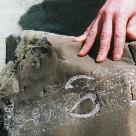
Wednesday, May 23. Today we will continue through the remaining "Squeezes" in the canyon. Below First Squeeze, the canyon opens up a little bit, but the gradient steepens slightly and the river bottom is often made of scoured sandstone bedrock. This makes for pretty strolling alongside little water slides. The canyon also carves through several layers of sandstone that are full of strange, bivalve-looking fossils. Views up the canyon from this point are spectacular, with great views of sedimentary strata and the occasional glimpse of purple sandstone in the upper reaches of the side canyons. You will grow very familiar with this purple sandstone, as it forms the huge boulders which litter the river canyon further down.
Second Squeeze is partcularly dramatic. The gradient is steep through it and the canyon walls are also very steep. The river itself is choked with big boulders and enormous pools. The sandstone bedrock is faulted and twisted. Staying dry through this section required a little bit of mellow rock climbing in 1999. This year, with warm May temperatures, we will safely negotiate the steep sections by having Eric and Scott haul back packs up and over the short sections that involve any climbing, and letting the students swim through the pools. The third, and final squeeze requires a mandatory swim. The canyon walls overhang a long, deep pool in the river. I don't have any pictures of this part of the canyon because Scott and I (and our friend Kevin who was also on the trip last year) got to it just before dusk and we were too cold swimming through it to think much about taking pictures. In May, however, the cool waters should be a welcome relief from the heat. We will carry plastic bags to keep our gear dry as we float our packs through this pool, swimming alongside them.
We will look for a camping area between the West
Fork of the Sespe, which enters the river shortly below the Third
Squeeze, and Tar Creek.
Thursday, May 24. Though we will have gotten through all the technical difficulties encountered in the three squeezes by this point, we will still have numerous obstacles in our pat. The canyon walls are not as steep here, and there are sections in which the river bottom flattens out to look like a floodplain, but huge boulders have been swept into this canyon from various tributaries. Some of these boulder fields require interesting route finding through crevices and over drops. The river alongside is full of water rushing over smooth sandstone boulders. This will be a short day of hiking with our packs. We will find a campsite upstream from Tar Creek, situated in a good place for hiking out along a dirt road that enters the canyon at that point.
Having set up camp, however, we will make a point
of taking a side trip a short way up Tar Creek to see the waterfalls
on it. This little canyon seems to be the source of many purple
boulders. The falls are a good reward for the task of getting up
through the boulders. (Too high to be captured in a single
photograph, you can see a collage
of three photos of the falls.) Below Tar
Creek we can day-hike through the Purple
Boulder Maze, which offers fun route
finding through boulders. This is utterly spectacular terrain!
Depending on time, we may be able to day-hike all the way to Devil's
Gate. Though we are closer to civilization here, the canyon still
maintains a sense of wildness. Last year we found bear
prints and mountain lion tracks all over
the sand in the river bottom , here, near our camp.
Friday, May 25. We will hike out of the canyon to the Forest Service Trailhead at Oak Flat to be picked up and taken back to Thacher.